A precision agriculture app that transforms how farmers monitor and analyze their crops through autonomous drone technology. Talyon enables modern data-driven agriculture by combining aerial imaging with AI-powered crop analysis to optimize agricultural decision-making.
Built as a hybrid React Native application with native Android (Kotlin) components, Talyon addresses the complex challenges of precision agriculture by providing an intuitive mobile interface for mission planning and real-time flight control.
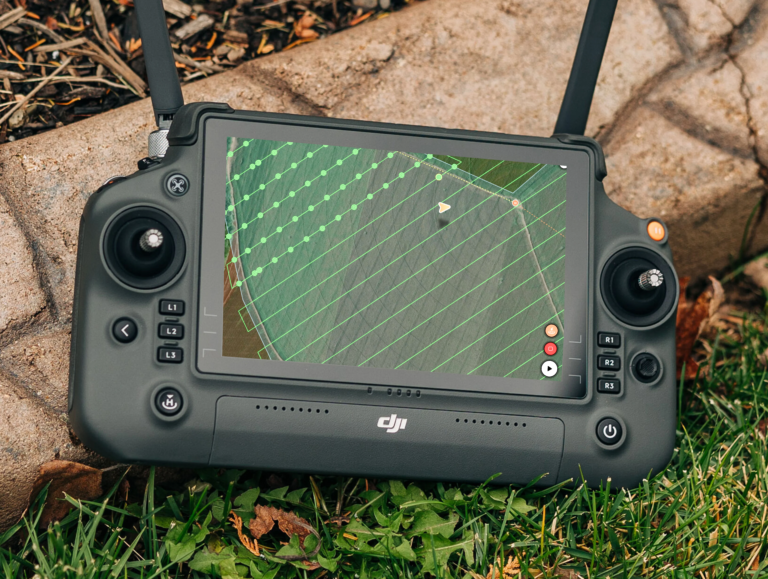
Built around MapLibre as a map engine, the mobile application transforms complex agricultural surveying into an intuitive, map-centric experience. Maps are the visual backbone, rendering interactive components that enable mission planning, autonomous flight monitoring, and comprehensive field analysis.
Users interact directly with the map to define survey boundaries, sketch flight paths, and visualize coverage patterns with pixel-perfect accuracy. The MapLibre integration ensures smooth zooming, panning, and rotation even when working with large farms and many crops.
As users adjust parameters like altitude, speed, and overlap percentages, React Native components and Zustand store instantly update maps to show modified flight paths, estimated coverage areas, and mission duration calculations. Interactive controls overlay the map surface, allowing users to fine-tune flight angles and turnaround distances.
The crop boundary editor is an intuitive point-and-drag experience built with React Native and MapLibre. Users define precise field boundaries through interactive corner points that can be dragged, while intelligent midpoint markers between corners allow new vertices to be added anywhere. The system maintains complete undo/redo functionality across all point operations.
The Flight App
I’ve built Android native components for flight operations in Kotlin that interface with the DJI Mobile SDK, which is a low-level Java controller, translating mission plans into precise aircraft commands through virtual stick controls. This native layer handles all safety-critical operations, including takeoff, waypoint navigation, and automated photo capture.
During autonomous flights, the Android native components provide precision drone control through dedicated background threads that execute mission commands while the main thread handles UI updates, built with Jetpack Compose, and user interactions. The system’s checkpoint-based architecture enables pause and resume functionality, allowing operators to interrupt missions for battery replacement and return to the exact flight path.
MapLibre integration at the native level renders real-time drone position, completed waypoints, and photo capture locations with sub-meter accuracy, while telemetry data, including battery levels, altitude, speed, and gimbal positioning, flows continuously between the aircraft and mobile interface to maintain complete situational awareness throughout the mission.
Backend Robustness
The Spring Boot backend architecture provides enterprise-grade data management that handles the complex synchronization requirements. Built with Kotlin and MongoDB, the system manages crop data, flight imagery, and telemetry through dedicated service modules that process everything from mission planning to post-flight analysis.
MongoDB change streams enable data synchronization between cloud and mobile devices through WatermelonDB’s offline-first architecture, ensuring field teams can operate effectively in areas with limited connectivity while automatically syncing when network access is restored.
The backend handles massive data volumes generated by drone operations, processing high-resolution imagery uploads through batch processing pipelines. Wasabi S3 integration provides scalable storage for aerial imagery and processed analytics. The photogrammetry pipeline leverages OpenDroneMap (ODM) running in containerized environments to transform raw drone imagery into precision orthomosaic maps and digital elevation models.
Conclusion
Talyon represents the convergence of mobile technology and autonomous systems in the service of modern agriculture. By combining intuitive React Native interfaces with precision Android drone control and intelligent cloud processing, the platform eliminates the traditional barriers between farmers and agricultural technology.
As a personal project currently under active development, the app continues to evolve through iterative development cycles, incorporating new features and refinements based on real-world testing.